
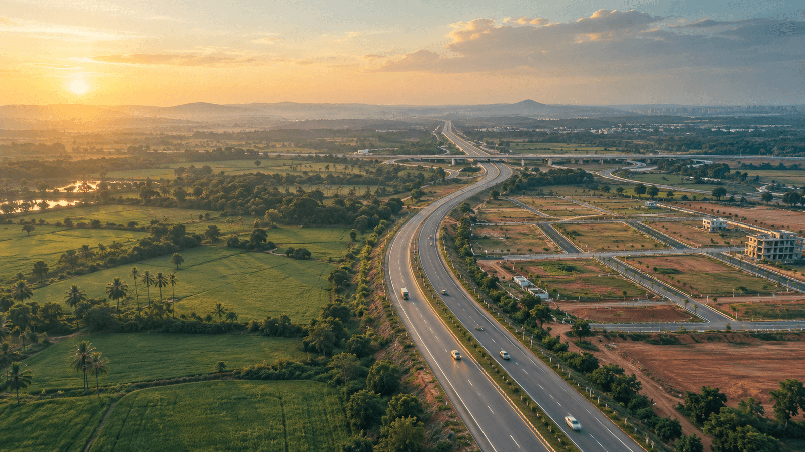
The NH-163 corridor is the Hyderabad–Warangal highway as it leaves the city at Uppal and runs east through Ghatkesar and Bibinagar to Bhongir and Yadagirigutta. It is roughly 50 km end to end. The stops differ a lot: some are dense city neighbourhoods, some are institutional hubs, one is a temple town. This guide goes through them in order.
For each stop you get a rough distance from Uppal, what is already there, and one thing to check yourself on a visit. Distances are approximate road distances taken from highway chainage, so confirm them on a live map. They are orientation, not promises.
The corridor at a glance
The status words in the last column mean: operational (running today), under construction, awarded (contract given, work not necessarily visible), proposed or announced (no commitment). Statuses were last checked in September 2026; confirm anything that matters to you.
| Stop | ≈ km from Uppal | What is there | Pending, with status |
|---|---|---|---|
| Uppal | 0 | Metro Blue Line, offices and industrial estates, bus stops | Uppal junction flyover (under construction); Uppal–Narapally elevated corridor (under construction) |
| Narapally | about 6 | East end of the elevated corridor, CPRI area | Corridor target June 2027 (stated target) |
| Boduppal / Peerzadiguda | about 3–6 | Dense apartment belt, former municipalities | Water supply upgrade for the wider city (under construction) |
| Pocharam | about 10–12, off the highway | Infosys campus, IT offices | Further campus phases (announced) |
| Ghatkesar / ORR Exit 9 | about 12–14 | ORR junction, railway station | MMTS extension via Ghatkesar (awarded) |
| Bibinagar | about 26–30 | AIIMS Bibinagar, railway junction | AIIMS full operation (under construction); MMTS stop (planned) |
| Bhongir | about 36–38 | District headquarters, fort | Fort ropeway and heritage works (under construction) |
| Yadagirigutta | about 46 to Yadgiri junction, temple 4 km further | Temple town, Raigir (Yadadri) station | MMTS terminus (awarded, no opening date) |
Uppal: the city-side gateway
Uppal is where most people start. It has a Blue Line metro station, with the line ending at Nagole about 2 km south, and a mix of IT and industrial employment nearby. It now sits inside the Malkajgiri Municipal Corporation.
The pinch point is the road itself. A junction flyover and a roughly 6.4 km elevated corridor to Narapally are both under construction, which means diversions and slow movement at the city end. In September 2026 the minister gave June 2027 as the new target for the elevated corridor after earlier dates were missed.
Check on a visit: drive the stretch at a peak hour and an off-peak hour. The gap between the two is the number that matters for daily life, and no brochure will give it to you.
Boduppal, Peerzadiguda and Narapally: the dense inner belt
Between Uppal and the ORR the corridor is mostly built-up. Boduppal and Peerzadiguda are established apartment neighbourhoods. Narapally, near CPRI, is where the elevated corridor is meant to end.
These areas were municipalities until the December 2025 order merging urban local bodies along the ORR into GHMC. That is an administrative change. It does not by itself change roads, water or drainage on the ground.
Check on a visit: ask residents about water supply and drainage in monsoon. Citywide water projects are under construction, but that is not the same as a connection to the lane you are looking at.
Pocharam: where the jobs are
Pocharam is a short distance off the highway and is known for the Infosys campus and nearby offices. For this corridor it is the clearest example of local employment east of Uppal. Published reports put east Hyderabad as a small share of the city’s apartment sales and office stock, so read it as an affordability-and-catch-up story, not as a second HITEC City.
Further campus phases have been announced. Announced is not scheduled, so do not plan around them.
Check on a visit: note the access road from the highway and the last-mile transport options. Staff-bus routes are a good clue to where people actually commute from.
Ghatkesar and ORR Exit 9: the ring-road connection
Ghatkesar is where NH-163 meets the Outer Ring Road at Exit 9 (the Annojiguda junction). The ORR is an operational, eight-lane expressway, and this exit is how you reach the airport side or the western suburbs without going through the city. Ghatkesar town and its railway station sit just beyond.
Two points readers often get wrong. First, there is no separate spur from the ORR to Bibinagar: NH-163 itself carries the traffic east of Exit 9, through Ghatkesar town. Second, Bibinagar is a good way past the exit, not next to it. Treat any quoted “10 minutes” with suspicion and time the drive yourself.
Check on a visit: drive Ghatkesar town at midday. Traffic through the town centre is where the eastward journey most often slows.
Bibinagar: the institutional anchor
Bibinagar is about 26 to 30 km from Uppal by our estimate. It has AIIMS Bibinagar, which is partly operational with an emergency department and outpatient services, and a railway junction. A ministerial target for full operation of AIIMS was given for December 2026; that is a target for a building still under construction.
Bibinagar lies outside the ORR, in the zone the state calls peri-urban. Day-to-day amenities are covered in our guide to living in Bibinagar.
Check on a visit: note what you can actually buy and reach on foot or by a short ride: groceries, pharmacy, schools, a bank. Hospital proximity is one item among many.
Bhongir: the district town
Bhongir, roughly 36 to 38 km from Uppal, is the district headquarters of Yadadri Bhuvanagiri. It has the fort, a market town’s services and government offices. Fort ropeway and heritage works are under construction, and an opening has not been confirmed in the sources we use.
If you are weighing Bibinagar against Bhongir, our comparison for plot buyers lays out which suits which kind of buyer.
Check on a visit: look at the town’s daily services in the evening, not only the highway frontage.
Yadagirigutta: a temple town
The Yadgiri junction is about 46 km from Uppal, with the temple roughly 4 km further. The temple draws large crowds on peak days, which shapes the local economy: hospitality, transport and services.
The MMTS rail extension from Secunderabad to Raigir has been awarded and track work is reported under way, but no opening date has been given. Private township launches have been announced near the town. Whether any of them proceed is for each promoter to demonstrate.
For how this stop compares with its neighbours, see Bibinagar vs Ghatkesar vs Yadagirigutta.
Check on a visit: go on an ordinary weekday, not a festival day. Festival crowds tell you about the temple, not about everyday life.
What Young India Housing has along the corridor
We develop plotted layouts at three points on this route. These are facts about our projects, not a prediction about the corridor.
- Eastern Meadows (121 plots) is beside AIIMS Bibinagar on NH-163. HMDA LP No. 1377/HMDA/SWDL/2026; TG RERA P02000010859 (verify at rera.telangana.gov.in). See Eastern Meadows.
- Diamond Ring Residencia (61 plots) is in Bibinagar. LP No. 000023/LO/PLG/HMDA/2021. It is not RERA-registered. See Diamond Ring Residencia.
- Saffron Gold Residencia is at Penchikalpad, Bhongir. LP 000272/LO/Plg/HMDA/2019; TG RERA A02500000513. See Saffron Gold Residencia.
You can look up any layout permit yourself on the BuildNow portal under Citizen Search, and registrations on the TG-RERA site. Do that before relying on anyone’s summary, ours included.
What this does NOT mean
- Distance is not drive time. A stop 12 km away can take far longer than one 30 km away, depending on hour and diversions.
- Being on a highway is not approval. A plot beside NH-163 still needs its own layout permit, clear title and a clean encumbrance record.
- A pending project is not a finished one. Anything listed above as under construction, awarded, announced or proposed may change in scope or date.
- Nothing here predicts prices. This guide describes what exists and what is pending. It says nothing about future values.
- It is not personal advice. Your budget, timeline and risk tolerance are yours to weigh with advisers you trust.
What to ask your lawyer (or advocate)
Whichever stop you are looking at, bring these to your advocate before paying a token amount:
- Is the layout permit genuine, and does it cover this exact plot? (Use BuildNow Citizen Search.)
- Does the project need a TG-RERA registration, and is the number valid and for this phase?
- Does the seller’s title trace cleanly back through the registered documents, and what does the encumbrance certificate show?
- Do the plot’s boundaries and area match the sanctioned layout?
- Are there pending court cases, mortgages or family claims on the land? (eCourts case search is a starting point.)
- Which civic body and ward does the plot fall under today, and who maintains roads and drains?
- Are there any notified road-widening or acquisition plans that touch the plot?
Our document verification guide and site visit checklist walk through these step by step, and you can learn to read an LP number in this explainer.
WhatsApp us at +91 6309-555-444 (https://wa.me/916309555444) to book a site visit or ask for the project’s document set.